Beware the Yukon Volcano!
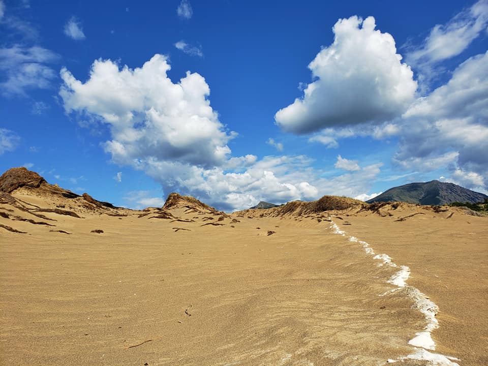
When you take a tour of the Yukon Territory, you may see an odd layer of clay-like sediment. Near the World’s Smallest Desert in Carcross, there are places where the gray-white layer of sediment stands out from the darker brown sand. While this layer of sediment is only about an inch thick in Carcross, it is much thicker further west. In some places, it’s more than 20-inches thick. So, where did it come from?

Here is a photo of the sediment I took in Carcross. My inquisitive nature sent me on a quest to discover the truth. Also, I think this photo kicks ash.
The sediment is ash fallout from the Bona-Churchill Volcano, located in the St. Elias Mountain Range about 258 miles west-northwest of Skagway. Everyone knows that volcanoes are no fun at all, so today’s blog is an informative romp to a time not-so-long-ago when the Bona-Churchill Volcano went BOOM and forever altered the course of history.
Imagine it’s 1,220 years ago
Indigenous First Nations people living around 800 AD in the St. Elias Mountains and regions to the east woke up one beautiful sunny autumn day without care or worry. Perhaps they were fishing for fall lake trout or harvesting berries. Suddenly, there was a terrible roar and the sky turned black. The people nearest to the volcano, the ancestors of today’s Tutchone people, recoiled in terror because they were dead in the path of a massive ash cloud.
Ash-induced lightning blazed electric terror from all directions as the cloud enveloped everyone and everything. Terrified animals ran for their lives. Fish and marine life struggled to survive as rivers and lakes were quickly choked and covered by the falling ash. Every living thing labored to breathe. In other words, it totally sucked.
How big was that volcanic eruption and ash cloud?
The Bona-Churchill volcanic eruption of 800 AD is considered the be the fourth largest in the world over the last 2,000 years. The ash is a combination of pumice, a light-colored rock called rhyolite, and volcanic glass, which is very lightweight. Sediment from this eruption has been found 7,000 miles away in ice-core samples from Greenland, Sweden, and Germany.
In other words, a whole lot of ash fell on the Yukon after the eruption. Winds were out of the west, so ash landed all over the Whitehorse, Carcross, and Southern Lakes region. This is the area where you travel on one of Skagway’s amazing Yukon tours! (Shameless plug)
What happened to the First Nations people?
Massive amounts of ash falling on your village makes for a bad day. The weight of the ash nearest the eruption toppled trees and was an overall bummer, especially when you consider the First Nations people had been living in the region for thousands of years. With winter fast approaching, the volcanic eruption was like getting the proverbial double-whammy.
Did you know that there are striking similarities between Athabascan-speaking First Nations people and the Navajo tribes in the Southwestern United States, especially in regards to their language? Now you do. Anthropologists believe that First Nations people fleeing their ash-covered lands in the Yukon migrated south along the coast and settled in the drylands of Arizona, New Mexico, Colorado, and Utah. They eventually became one of the largest tribes of American Indians.
The vacated Yukon lands were settled by coastal First Nations people a few decades later. How do we know this? SCIENCE! About 1,200 years ago, hunting weapons used by interior tribes changed from darts to bows and arrows. You see, coastal tribes used bows and arrows but not the interior tribes. When the ash-ravaged interior could once again support life, coastal peoples moved into the interior and brought their technology along with them.
Thank you, science! You make learning fun.
Everything you see on a Skagway Tour is a learning experience, even a thin gray line of clay-like sediment. We hope you enjoy your Yukon tour and will certainly keep you informed of any potential volcanic activity in the region. But for now, Beware the Yukon Volcano!


